
Every traveler in Boston has faced that moment when the navigation app shows two routes: one shorter, one longer. Logic says the shorter one must be faster. Yet, those who have driven across Boston’s maze-like streets know that logic often fails. From narrow roads near Beacon Hill to unpredictable traffic on Storrow Drive, the fastest path on paper rarely turns out that way on the ground.
Boston’s urban layout tells a story of history meeting modern growth. The city was never built for cars, which means shortcuts can quickly turn into detours. Understanding why distance alone is not the deciding factor can completely change how you plan a trip, especially when time, safety, and reliability matter most.
Distance Does Not Equal Time
It’s easy to assume a shorter route saves time, but in Boston, that’s rarely true. The shortest road often cuts through busy intersections, low-speed zones, or residential streets. During the day, even a mile-long shortcut through downtown can take longer than a five-mile highway stretch. The city’s traffic pattern changes throughout the day. A quick trip across the Charles River might take ten minutes at dawn but nearly forty during rush hour. Choosing a slightly longer route along major roads often reduces stops, keeps a steady pace, and results in an earlier arrival.
Traffic Flow and Road Conditions Matter
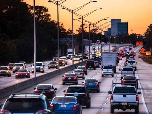 Boston’s streets are full of unexpected slowdowns. Construction near the Green Line, lane closures, or weekend events can block even the most direct route. Apps may not always reflect these delays accurately, leaving travelers stuck behind cones or rerouted through narrow alleys. Shorter paths also tend to weave through older neighborhoods with tighter roads, sharp turns, and frequent signals. Those roads may look appealing on a map, but they can break the flow of travel. Meanwhile, longer highways such as the I-93 or the Mass Pike maintain steady movement even during moderate traffic.
The lesson is simple: the map’s shortest option is not the same as the city’s most practical one.
Safety and Surroundings Count More Than Speed
When traveling late at night or during harsh weather, safety outweighs saving a few minutes. A direct backstreet might shave off half a mile, but if it’s poorly lit or rarely patrolled, it adds risk. Boston’s coastal climate often brings fog, snow, or heavy rain. Conditions like these make it wiser to take better-maintained and well-lit main routes, even if they stretch your travel distance. The slightly longer way through familiar or open areas ensures both visibility and comfort.
Smart travelers in Boston know that safety is part of time management. A secure route is not just about avoiding accidents; it’s about reducing anxiety and ensuring peace of mind.
Road Quality and Predictability Affect the Experience
 Every road tells its own story, and not all of them are pleasant to drive through. Cobblestone streets near the North End, uneven surfaces in older neighborhoods, or narrow lanes in Cambridge can slow you down even when your destination is close. The longer routes that follow highways or arterial roads tend to have better maintenance, fewer sharp turns, and consistent speed limits. They might cover more miles but create a smoother rhythm of travel.
The Cost Equation Is Not Just About Distance
Distance correlates with fuel consumption and wear-and-tear, so the shortest route often seems more economical. But if the route forces you into constant braking, slow speed, and multiple stops, you lose those savings. Some trade-offs to consider:
- More mileage might mean higher fuel cost, but less idling and fewer stops may offset that, making the longer path more cost-effective.
- Time has value: spending more time stuck may cost you in productivity or stress.
- Safety has cost: if a shorter route involves risk (poor lighting, higher collision chances), it may cost more in the long run.
Thus, the decision is multi-dimensional: minimize distance, minimize time, minimize risk, and depending on circumstances, one dimension may dominate.
Public Transportation Service in Boston
The heart of Boston’s daily travel network is the Massachusetts Bay Transportation Authority (MBTA). It operates the subway, buses, ferries, and commuter trains that connect the city and surrounding towns. While the T remains the backbone of urban mobility, it is not always the quickest option for every route.
During peak hours, the subway may face slowdowns or maintenance delays, while off-peak times reduce frequency. Choosing to stay near MBTA lines or plan around its schedule often makes trips more reliable, even if they add a few extra minutes of travel.
Private Transportation Services
When Boston’s public transport slows down and ride-hailing becomes unpredictable, private car services play a vital role. These services support late-night travelers, corporate professionals, and airport transfers when reliability matters most. Private transportation options in Boston usually include well-maintained sedans, SUVs, and vans that operate on flexible schedules. A private chauffeur familiar with Boston’s traffic rhythms knows which tunnels to avoid, which roads are likely to close during events, and which detours actually save time. In the surroundings of 175 William F McClellan Hwy, Boston, MA 02128, where boston car service provider BlueNileLivery operates, the company continues to represent the reliability that late-night commuters look for with over 12 years of trusted experience for travelers. For those returning from Logan Airport late at night or traveling between suburbs like Brookline, Cambridge, or Quincy, private transportation offers the balance of safety, timing, and reliability that public systems may lack after hours.
When a Longer Route Is Actually Better
A smart traveler in Boston looks beyond the map. The longer route along the Charles River or through the Mass Pike corridor often gives more control over timing and environment. You might travel extra miles, but avoid frustration, reduce stress, and arrive feeling composed.
Even for daily commuters, small route adjustments can make a major difference. Choosing wider roads with clearer signals and steady flow can cut total travel time across the week, improve fuel efficiency, and provide a safer ride.
How to Decide the Best Path
Here are some prompts you can ask when planning a route:
- Is this route trusted or well-used, with good road surface, lighting, and signage?
- What is the average speed likely to be, given time of day, traffic, and stops?
- Are there potential delays on the “shorter” route (traffic lights, merging lanes, construction)?
- Are you traveling in unfamiliar territory or under conditions (weather, night) where safety should be a priority?
- What is the cost trade-off: extra miles vs. extra time vs. risk?
- Does your route pass through well-served transit or support services or through thin pockets of infrastructure?
By thinking beyond just the mileage, you will arrive at smarter decisions.
Final Thoughts
In a city like Boston, the shortest route is rarely the smartest one. Between the unpredictable traffic, historic road design, and seasonal weather, a few extra miles often save both time and stress. The real art of travel lies in choosing the route that fits your timing, comfort, and safety needs, not just the one that looks shortest on your screen.
For anyone moving across Boston, whether by MBTA, highway, or private service, the best route is the one that lets you arrive relaxed, on time, and without complications. In the end, it’s not about counting miles. It’s about choosing the journey that truly works.